Knighton and district
Some Victorian maps
  Maps of Knighton and the border parishes  
 

Queen Victoria's reign saw the first properly surveyed maps being published. The Ordnance Survey is the government department which undertakes this work.

Choose from the list below. You will find it useful to compare these old maps with a modern Ordnance Survey map of the same area to see what changes have occured. Unfortunately we cannot put these on our website.
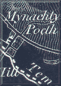
 
Knighton in 1833 (and 1865!)
Knighton around 1900
 
 
Llangynllo around 1840
Llangynllo in 1903
 
 
Beguildy around 1840
Beguildy in 1903
 
 
Heyope around 1840
Heyope in 1903
 
 
Bleddfa around 1840
Bleddfa in 1903
 
 
Stanage in 1833
Stanage around 1900


Back to Knighton menu


Back to top
Go to places menu