
TITHE MAPS
In Victorian times almost everyone had to pay tithes to the Church of England. At the beginning of the reign the tithe became a tax on your property. The maps were drawn to see what property everybody had
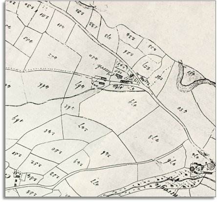
| Beguildy around 1840 | ||
|
The map below is based on the tithe
map of the 1840s and it
gives us an idea of the village of Beguildy
in the early Victorian period. |
|
TITHE MAPS In Victorian times almost everyone had to pay tithes to the Church of England. At the beginning of the reign the tithe became a tax on your property. The maps were drawn to see what property everybody had |
|
|
| Most people in the parish lived in scattered farms and cottages. Even though this area must have seemed remote in early Victorian times the community had its own craftsmen, and many people lived their whole lives without visiting a large town. | ||
|
In the village itself in 1841 the blacksmith was George Phillips aged 45. The village inn was the Oxford Arms run by old Alexander Joseph, and the vicar was Richard Hamer. |
||
|
|
|
|