| Beguildy in 1903 | ||
|
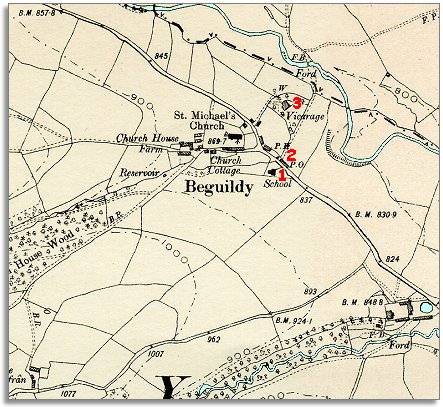
The map below is a section of a map
made at a scale of 6 inches to
1 mile in 1903. |
|
|
|
|
| 1.
The map above also shows that the hamlet has a new
school at the roadside. By the end of Queen Victoria's reign
all the local children would have had an education up to 13. Most local
children would spend there whole school lives in this one tiny building.
The education they had would open up new opportunities for them. (To find out more about Victorian school life in the area, click here). |
||
| 2. A new Post Office and shop have been built. This would have been very important to the community in a fairly remote spot. By the end of Queen Victoria's reign more people could read, so letter writing was a very good way of keeping in touch. | ||
|
3. A large new vicarage has been built for the vicar of this large parish, which stretched from Knucklas to Crygybyddar. |
||
|
|
|
|