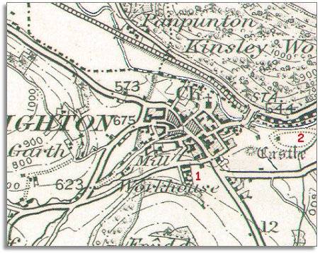
| Knighton around 1900 | ||
|
The map below was made around 1900 at the same scale as the 1865 map. By comparing the two we can see that the town did not grow dramatically during Victoria's reign, but there were some changes. |
|
|
 |
|
| 1. A workhouse has been built on the southern edge of the town. This building is now part of Knighton Hospital. To find out more about the workhouse visit the pages on Care of the poor. | ||
| 2. On land to the east of the town a racecourse has been set up in a figure-of-eight shape. (You can just see half of it here). Sports fields occupy the site now. | ||
| Compare with Knighton in 1833 (and 1865!)... | ||
|
|
||