| Knighton in 1836 (and 1865!) | ||
|
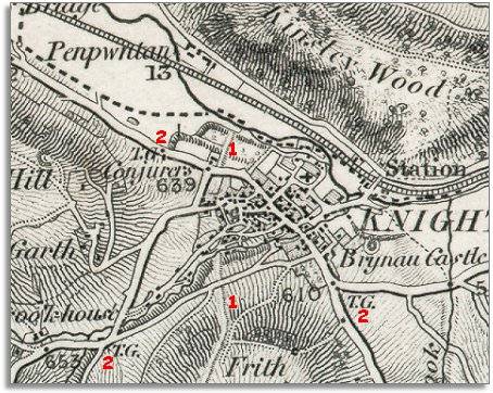
In a way the map on this page lets
us see Knighton at two different years on the same map ! |
|
|
|
|
| The shading on the map gives us a very clear idea of the shape of the landscape and the hill slopes. | ||
| 1. Clearly visible on the map is Offa's Dyke. Knighton developed at this point to control the crossing over the Dyke, which was a border between England and Wales. There was also a bridge over the river here. | ||
| 2. On the roads out of town we can see the tollgates (marked T.G) built by the Turnpike Trusts. Everyone other than those on foot would have to pay to get onto the next stretch of road. | ||
| Compare with Knighton in 1900... | ||
|
|
|
|