| Heyope in 1903 | ||
|
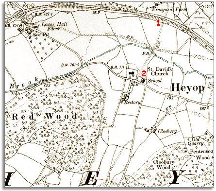
The map below is a section of a map
made at a scale of 6 inches to
1 mile in 1903.
|
|
|
|
|
| 1. The railway age has come to the area since the tithe map was made in the 1840s. This was the Central Wales Railway, built in the 1860s, which connected this remote rural area with the English midlands and with South Wales. For local people it made a short journey to market day in Knighton much easier. | ||
|
2. The map above also shows that the hamlet has a new school next to St David's church. By the end of Queen Victoria's reign all the local children would have had an education up to 13. Most local children would spend their whole school lives in this one tiny building. The education they had would open up new opportunities for them. (See the pages on Victorian school life in the Knighton area). |
||
|
|
|
|