| Bleddfa in 1903 | ||
|
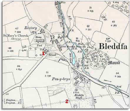
The map below is a section of a map
made at a scale of 6 inches to
1 mile in 1902. |
|
|
|
|
| 1. Perhaps the most important change is the village school. By the end of Victoria's reign all children in the parish had an education, even those from the poorest families. This meant they had more opportunities when they grew up. Instead of having no posssibility of a life anywhere but working on the land, children were given enough education to enable some of them to do something different with their lives if they wanted to. | ||
|
2.
The dotted line at the bottom of the map shows the line of the water aqueduct
from the Elan Valley reservoirs to Birmingham. The building of this brought
work to all the small Radnorshire communities it passed through. |
||
|
|
|
|