| Llangynllo in 1903 | ||
|
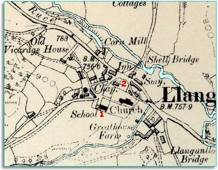
The map below is a section of a map
made at a scale of 6 inches to
1 mile in 1903.
|
|
|
|
|
| 1. Although there was a school somewhere in the village in 1841, there is now a new school for all the local children. This was important because it gave children a real education, and gifted children could have more opportunities in life than simply working on the land. | ||
|
2. A nonconformist chapel has been built in the area, giving local people another choice for worship besides the local church. |
||
|
|
|
|