| Stanage around 1900 | ||
|
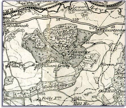
The map below was made around 1900 at the same scale as the 1833 map. By comparing the two we can see that the area did not change dramatically during Victoria's reign, but that there were some changes. |
|
|
|
|
| At the top of the map we can see the railway in the Teme valley connecting the area with the wider railway network and greatly improving transport and travel opportunities. The nearest station was at Bucknell, just over the border. | ||
|
There has been more tree
planting since the beginning of Queen Victoria's reign. At
Stanage, Park Bank now has a wood on it and there has been more planting
near Green Farm. |
||
|
|
|
|