
Caehopkin School 8
A growing community
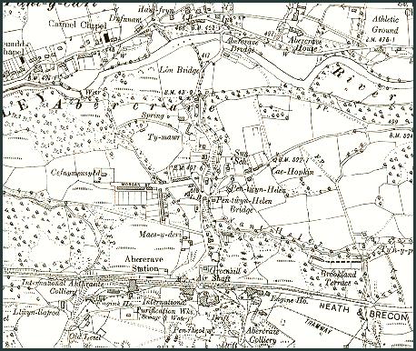
By 1920 the community served by Caehopkin School had grown considerably as can be seen on this Ordnance Survey 6" map dating from around 1920.
The coal workings to the south of the railway have extended considerably and there has been much housing development to accommodate the extra workers and their families.
Caehopkin
around
1920
From the
2nd Edition
Ordnance Survey
6" Map
Powys
County Archives
To compare this with the area in 1890 visit Caehopkin
School 1.
To see the school building in 1999 visit Caehopkin
School 12
There are 12 pages on Caehopkin School. Use the box links below to view the other pages.