| |
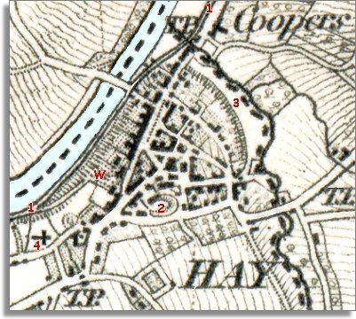
1.-The
line of the tram road can clearly be
seen on the map running through the town along the banks of the Wye. At
the point marked W was the wharf where trams could be loaded and unloaded.
(See the pages on the Tramway to find out more.) |
|
| |
2.-The
Castle at Hay can be clearly seen on its mound. By the time this map was
made the castle was no longer in use as a fortress. A house had been built
in the castle precincts from the stone in the 17th century. For most of
the Victorian period it was occupied by the Rev. W.L. Bevan who was the
vicar of St. Mary's and a familiar figure to the townspeople. |
|
| |
3.-The
North and Eastern edge of Hay ends at the line of the medieval walls of
the town as it still does in 2001. |
|
| |
To find out what sort of people are
living and working in Hay at the beginning of Queen Victoria's reign,
go to the pages on earning a living.
Compare with
a map of Hay in 1887..
|
|