Talgarth and district
Victorian maps
  Bronllys in 1839  
 

The map below is based on the tithe map for the parish of Bronllys, and it gives us a good idea of the layout of the village just two years into Queen Victoria's reign.


TITHE MAPS
In Victorian times almost everyone had to pay tithes to the Church of England. At the beginning of the reign the tithe became a tax on your property. The maps were drawn to see what property everybody had.
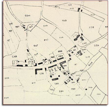
  The medieval Welsh settlement pattern was for people to be living in a scatter of farms and cottages. It was only in Victorian times that many of the villages in Powys began to develop. Here, though, we can see a well established village which has grown up at a crossroads next to the stronghold of Bronllys Castle.  
  At the top left of the map you can make out the strips of an ancient open 'common' field still in use in Bronllys. To find out more on this system in the area see the pages on the Cole Brook Common Field  
 

At Marish around this time lived Benjamin Price (aged 70) with his family and servants, while at Coldbrook (or Cole brook) were several families of working people including a grocer Walter Meredith, and Roger Davies who was a shoemaker.
The village also had 3 masons, 2 tailors and a carpenter.

Compare with Bronllys in 1887...


Back to Talgarth maps menu

Link to sources
Back to top
Go to Talgarth menu