Talgarth and district
Victorian maps
  Bronllys in 1887  
 

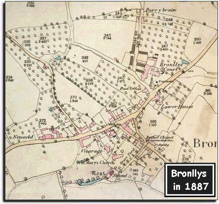
The image below is based on an Ordnance Survey map published in 1887 at a scale of 25 miles to 1 inch. This big scale allowed the map makers to put a lot of detail on the map.
Here we can see that the overall shape of the village has not changed that much though there have been changes to people's lives.


  We can see at a glance that the open field with strips, which was visible behind Neuadd on the tithe map, has by now been enclosed. While this may have made the land more productive it also meant that the poorer people of the village could no longer use the land for grazing.  
 

Bronllys had a school in 1839, but the map above shows a new school by the church. By this time all local children had an education. Whether they enjoyed it or not the children would have found it better than working long days on the land !
(See the Talgarth schools pages).

Compare with Bronllys in 1839...


Back to Talgarth maps menu

Link to sources
Back to top
Go to Talgarth menu