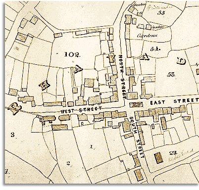
The map gives us a good idea of the community in the early years of Queen Victoria's reign. It shows us how the town developed where two important roads meet.

| Rhayader in 1840 | ||
| The map below
is based on the tithe
map of 1840. It was made
by the church authorities for tax purposes. The map gives us a good idea of the community in the early years of Queen Victoria's reign. It shows us how the town developed where two important roads meet. |
||
 |
||
| From
south to
north runs the turnpike road along the Wye valley connecting
Rhayader with North and South Wales. From the east
comes the turnpike road which connects Rhayader with the county town at
Presteigne and the borders. And to the west
lie the mountain roads to the Elan valley
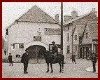
and Cwmystwyth. Such a meeting of ways - together with the bridge over the Wye - made Rhayader the perfect place for a local market to develop. The map shows the Market Hall (see right) at the crossroads where the town clock now stands, and shops and inns stretching along the roadsides. |
 |
|
|
The thin line running down North Street and then turning along West Street is the line of the Bwgey Brook. This was very much an important landmark as well as a source of water. (See the page on the Bwgey Brook). Compare with
Rhayader in 1904... |
|
|
||