Rhayader
Victorian Maps
  Nantmel in 1904  
 

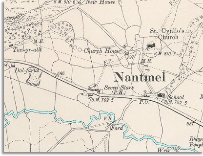
The map below is a small section of an Ordnance Survey map made in 1904. It gives us an idea of what Nantmel was like at the end of Queen Victoria's reign.
If we compare it with the map of Nantmel in 1840 we can see what changes have occurred.

 
  map of Nantmel in 1904
  The first thing that can be seen is that the village has not grown much from the beginning of Queen Victoria's reign. There is a new house Dol-farus at the side of the turnpike road, and another called New House high on the bank above the church.
Apart from that, Nantmel is still the tiny hamlet it was in 1840. (Look at the Nantmel population graph to see how the population changed).


A school can be seen on the map at the bottom of Church Lane. This really did make a big difference to ordinary working people growing up in the area. Learning to read and write and do basic arithmetic gave children a chance of better job opportunities when they left school. Even so, a great many children would still grow up to work on the land or go into service.
(See the School Life pages for more on victorian schools in the area.)

Compare with Nantmel in 1840...


Back to Rhayader maps menu

link to sources