Rhayader
Victorian Maps
  St Harmon in 1866  
 

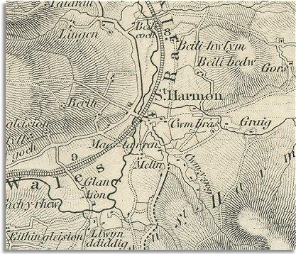
The map below shows St Harmon in the year 1866, soon after the Mid-Wales railway opened.
It is an enlarged section of an Ordnance Survey map. Like many small rural communities, the population is mainly scattered across the landscape in farms and smallholdings, with just a small hamlet around the parish church.

 
  Map of St Harmon in 1866
  In Victorian times most of the inhabitants worked on the land as farmers, farm labourers, shepherds or farm servants.
The shading on the map shows the shape of the rugged hills well. The sheep that grazed these hills gave the local people their living.
 
  The building of the railway down the Marteg valley connected this small community with the great Victorian railway network. This enabled farmers to send their products to markets further off, and made personal travel much easier.
Even after the coming of the railway though, St Harmon was still a scattered farming community. Unlike some of the small towns in Powys, this community was not greatly changed by the railway.
(Look at the population graph for St Harmon to see how St Harmon's population changed in Victorian times).


Back to Rhayader maps menu

link to sources