On
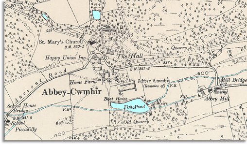
the western edge of the map we can see a school. The Abbeycwmhir
school was built in 1857, and it was a great benefit to local
families in the long run. It meant that local children would be given a
basic education and so would have more opportunities open to them when they
left school.
 (See
the Victorian School Days pages
to find out more about local schools) (See
the Victorian School Days pages
to find out more about local schools)
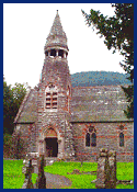
St. Mary's
church is a fine new building erected in 1866. Abbeycwmhir
used to be a part of Llanbister parish, but it is now a parish in its
own right with a parish church.
The Abbey
Hall has itself been rebuilt in 1867 by the same architects
who designed the church. This replaced an earlier building which was probably
from the 17th century.
Compare with
Abbey Cwmhir in 1833...
|