![]() |
![]() |
||||||||||
|
|||||||||||
Rhayader Victorian Maps |
Abbey Cwmhir in 1833 | ||
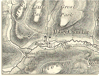
This image is taken from an Ordnance
Survey map first surveyed in 1833. |
||
![]() |
Abbey
Cwmhir was settled by by Cistercian monks who built the abbey
there in 1143. The ruins of the buildings
can be seen today and are marked on this map of 1833. The monasteries were abolished and the lands of the monks became a private estate with Abbey Hall at it's centre. For many years this estate was the home of the Fowler family who established the Great and Little Parks which are marked here. |
||
The monks probably had a mill here in their day, and a corn mill is clearly marked on the map in 1833. Water power was harnessed to drive all sorts of machinery in the countryside. In this case it drove mill wheels for grinding the grain of local farmers into flour. | ||
The map of 1833 shows the area to be sparsely populated. Look how few houses and farms there are on the map. (See the Abbey Cwmhir population graph to see how many people there were in the parish.) |
|
||