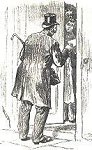
The man from the census calls
 The
population of this border area changed
throughout the Victorian period as people moved about to earn a living.
Information about the local population was recorded in the censuses
which were taken every ten years. Men were employed to travel round
the district recording who lived in which house and what they did. The
population figures are taken from these records.
The
population of this border area changed
throughout the Victorian period as people moved about to earn a living.
Information about the local population was recorded in the censuses
which were taken every ten years. Men were employed to travel round
the district recording who lived in which house and what they did. The
population figures are taken from these records.
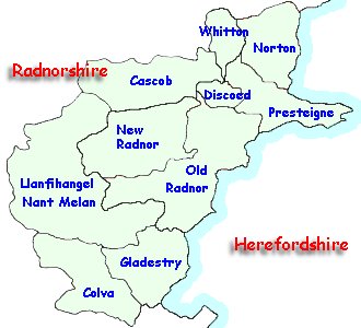
Britain was divided into parishes
(shown on the map) and the figures record how many people lived in the
parish. The parish usually consists of the village
around the parish church and the area around it. Some parishes
contain several small
communities.
Choose from the list below to see graphs of the population of some local parishes in the Victorian period.