Llanfair and district
Victorian maps
  Llanfair Caereinion in 1836  
 

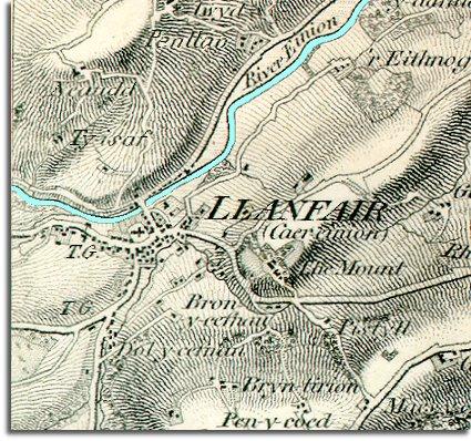
The map below is an enlarged section of an Ordnance Survey map made at a scale of 1 inch = 1 mile in 1836. Although it is not very detailed it does give us an idea of the area in the early Victorian period.
The way the map is shaded gives us a very good idea of the shape of the landscape. You can see that the river runs through a narrow valley at this point and it is clear that the town grew up around a convenient river crossing.


  You will be able to pick out the cross shape of the parish church standing in its churchyard near the bridge. At this time it is clearly the biggest building in the town. You can also see that there are no gaps in the spread of houses so there has obviously been much rebuilding after the fire of 1758.  
  Marked T.G. on the map are two tollgates on roads going south and west from the town. This is where anyone travelling with an animal would have to pay to use the next section of road. (To find out more about tollgates and turnpike roads visit the Transport section under Topics)  
  Compare with the map of the town in 1902  
 

Back to the Llanfair maps menu

Back to top
Go to Llanfair Caereinion menu