Hay and the Wye valley
Victorian maps
  Llyswen in 1887  
 

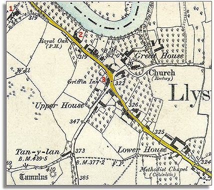
Below is a detail of a large scale map based on the Ordnance Survey map made at a scale of 25 inches to 1 mile. By comparing it to the map of Llyswen in 1840 we can see that not a great deal has changed in the village, though the map shows even more orchards. The low-lying valley land is sheltered and fertile and can support orchards which would struggle on higher ground.


  1 This large new house is a new rectory for the local rector or vicar. In 1840 this land was open strips of common land but like the large Common Field in the top right of this map it has been enclosed.  
  2 The Royal Oak public house has opened for business! This was a group of 3 cottages in 1840.  
  3 The Griffin Inn. In the days before motor cars travelling took much longer and so Inns were needed for travellers to stay in. The Griffin Inn was at the heart of the village in 1840 too, as it still is today!  
 

Compare with Llyswen around 1840...
Back to the Hay maps menu
.

Back to top
Go to Hay menu