Hay and the Wye valley
Victorian maps
  Llowes around 1900  
 

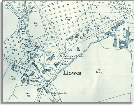
The image below is based on a large scale map made by the Ordnance Survey around the end of Queen Victoria's reign. By comparing it to the map of the hamlet in 1840 we can see that not a great deal has changed on the map though there have been changes to peoples lives.


Llowes around 1900
  The school at Llowes is still in operation (at the roadside by the church yard) but by this time all children in the parish attend it and have the opportunity for an education.  
  The Post Office is marked on the map (P.O.) by the church yard. By the end of the reign of Queen Victoria many more people in the area could write and as family members moved around in search of work, letter writing became more important.  
 

In the late 1890s William Pritchard was the landlord of the Radnor Arms and the village shopkeeper was Septimus Bowen. He also was a shoemaker. In rural areas where the population was small craftsmen would often have to do more than one job to make ends meet.

Compare with the map of Llowes around 1840..


Back to the Hay maps menu

Back to top
Go to Hay menu