| |
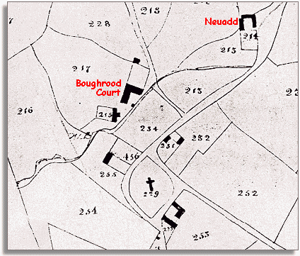
The
map shows the hamlet of Boughrood to be a small scatter of farms near the
church. Boughrood Court belonged to
the Maesllwch estate as a great many other farms in the area did. In 1841
the census listed the tenant of Boughrood Court as Edward Powell who lived
there with his wife Mary and their 5 children. The eldest was Charles at
20 years old and the youngest Roger who was 10. None of them went to school
and they probably all worked on the farm.
Also at the Court were a wheelwright
and his family. |
|
| |
The
building marked 215 on the North Western side of the church yard
next to Boughrood Court is listed in the Tithe records as Church
House. It too was part of the Maesllwch estate. In early Victorian
times these rich landlords were very important people in the community. |
|
| |
Neuadd
belonged to another rich landowner, Arthur Macnamara. The tenant was Thomas
Pugh who farmed there with his family.
. |
|
| |
Compare
with the map of the hamlet in 1887 |
|