| |
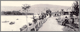 1.
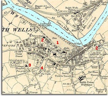
The Gro has been developed further since
1888. A tree-lined path along the river has been made (see right), and a
boating pavilion and landing stage built. North Road has been built with
houses overlooking the river. 1.
The Gro has been developed further since
1888. A tree-lined path along the river has been made (see right), and a
boating pavilion and landing stage built. North Road has been built with
houses overlooking the river. |
|
| |
2.
Two more schools have been built in
Builth. Before this most children went to an elementary school as an infant
and stayed until they were 13 and then left for work. By the end of Queen
Victoria's reign the more able pupils could go on to the Intermediate
School in North Road which is a secondary school like High School.
Many poor families still could not afford this though.
The other new school is one for infants at the East end of town in the shadow
of the old castle mound. |
|
| |
3.
A Cottage
Hospital has been built in the town.
It opened in 1897 and was paid for by wealthy local people who believed
that poorer people should get some hospital care when they needed it. |
|
| |
4.
In the large house called The Castle live a local solicitor and his family.
At the time Queen Victoria died the solicitor's daughter Hilda
Vaughan was just a young girl. She grew up to be a famous novelist
writing about the local area. |
|