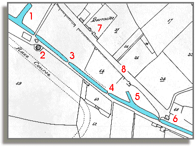
The map on this page is from a tithe
map of 1841, and it shows part of
the Brecon "terminus"
of the canal, here coloured in blue.
By this date there were many buildings along the Watton,
few of which are marked on the map.
The canal continued a little beyond the top left of this portion of map,
with two more wharf areas for loading
and unloading goods. Much of the most valuable trade on the 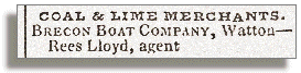 canal
was carried by the Brecon Boat Company,
which operated 16 canal boats in 1820,
each of which could carry 21 tons of coal. Their large wharf is shown
top left at 1 on this map.
canal
was carried by the Brecon Boat Company,
which operated 16 canal boats in 1820,
each of which could carry 21 tons of coal. Their large wharf is shown
top left at 1 on this map.
|
Tithe
maps from
the early Victorian years, like the one below, were drawn up to
show who owned land and property for charging tithes or taxes.
The original numbers in black on this map were matched to a list of owners and tenants. |