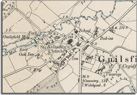
The image below is put together from
a detailed Ordnance
Survey maps made in 1901.
It gives us a picture of the community around the end of Queen Victoria's
reign, and we can see that there have not
been many changes
in the area.
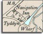 The
canal branch to Guilsfield was still
open at this time, but traffic on it had fallen considerably since the local
railway had opened.
The
canal branch to Guilsfield was still
open at this time, but traffic on it had fallen considerably since the local
railway had opened.