Talgarth and district
Victorian maps
  Talgarth in 1887  
 

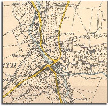
The map below is a section of a map made at a scale of 6 inches to 1 mile in 1887.
Although the town looks very similar to how it did in 1841 there have been some changes during Victoria's reign.
The mapmakers have indicated the orchards which surrounded the town then. The locals must have liked their cider !


  One major change which has come to Talgarth is the arrival of the railway. You can see that it takes a similar line to the old tramway which it replaced. This time, though, passengers as well as goods were carried and this railway connected with many others, making travel across Britain much easier.  
 

By comparing this map with the map of 1841 you can see that new houses have been built since the early years of Queen Victoria's reign. Many of them have long gardens at the back.
How many new buildings can you spot?

Compare with the map of 1841...


Back to Talgarth maps menu

Link to sources
Back to top
Go to Talgarth menu