The map below is a section of a map
made at a scale of 6 inches to
1 mile in 1887.
Although the community looks very
similar to how it did in 1841 there have been some changes during Victoria's
reign.
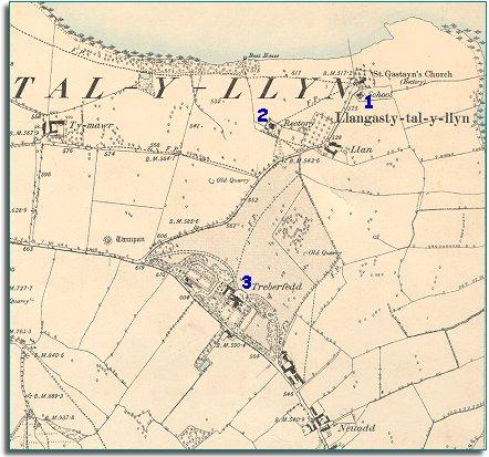
| Llangasty Talyllyn in 1887 | ||
|
The map below is a section of a map
made at a scale of 6 inches to
1 mile in 1887. |
||
|
||
| 1. The village now has a school for all local children. This meant all local children had an education which could give them more opportunities when they grew up. It was better for the children to go to school than to start work while still very young. (See the school life pages). | ||
| 2. A nice new rectory has been built for the local clergyman in charge of the parish. | ||
|
3. The grounds of the grand house, Treberfedd have been developed further with lawns, trees and parkland. |
|
|
|
|