|
Compare
with map of the area in
1839
|
| The enclosure of the common field | ||
|
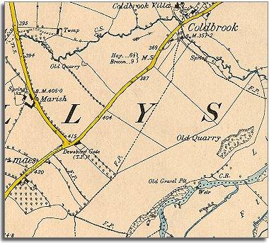
The map below is a section of a map
made at a scale of 6 inches to
1 mile in 1887. |
|
|
| You
can see that the rows of narrow strips have now been amalgamated or put
together into larger fields, although
some of the shapes are recognisable from the earlier map. By the Dewsbury Gate you can still see the narrow strip of orchard which was marked as belonging to William Price in 1839. These new large fields could be made more productive but the poorer families who were able to graze before no longer have access.
|
|