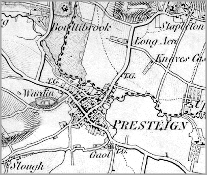
The T.G. which is marked on three of the roads out of the town indicates the position of the tollgates at the time. With no railway built yet the turnpike roads were the only transport links with the outside world. (see Presteigne transport pages).
The Gaol marked on the map on the southern edge of the town was the County Gaol for Radnorshire, where criminals sentenced in the court in the Shire Hall served their sentences. (see Presteigne Crime and punishment pages).