Llanidloes
Victorian maps
  Llandidloes in 1836 (and 1859!)  
 

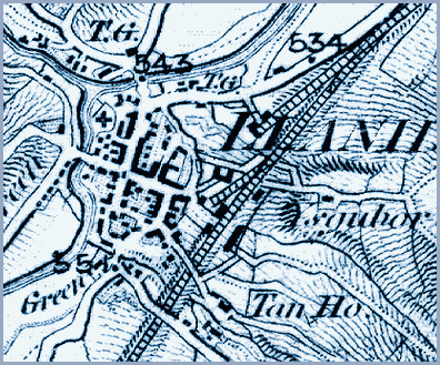
Like the 1836 maps for Caersws and Llandinam, this map of that year has the later railway added on to it. From it we can get a picture of the town at the beginning of Queen Victoria's reign.
The basic shape of the town and its streets is the same as that of the town in the Middle Ages, though the houses would have been rebuilt many times. The Market Hall is visible at the crossroads in the middle of town.

 
  Llanidloes in 1836  
  You can see that the town is situated at this spot because it is an important crossing place over the River Severn with two bridges.
The Clywedoc also flows into the Severn at the top left of the map with routes going off over hilly country to Machynlleth and Llanbrynmair.
In 1836 you could travel these routes along turnpike roads but unless you were on foot you would have to pay a toll at the tollgates (marked T.G. on the map).


Llanidloes in 1903...

Back to Llanidloes map menu