Llanidloes
Victorian maps
  Llandinam in 1836 (and 1859!)  
 

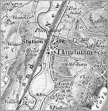
Like the map of Caersws in 1836 this map has had the railway added to it at a later date. The scale of the map does not allow us to see details of each building and what they were used for but we can still learn a lot about early Victorian Llandinam.

 
  !" map of Llandinam in 1836  
 

The way the mapmakers shaded in the hills gives us a good impression of the landscape. From this we can see that the village grew up at the side of a major route along the Severn valley between high hills, where there was a river crossing.
At the beginning of the Victorian period this was a turnpike road and travellers would have to pay a toll to use it.

This is very much a farming community with bigger farms on the valley floor and smaller farms on the hillsides and uplands.


Llandinam in 1903...

Back to Llanidloes map menu