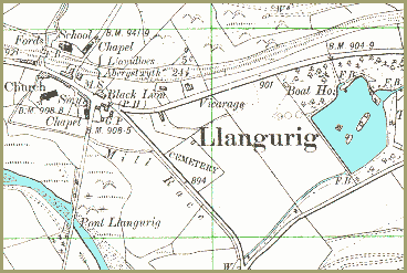
Llangurig in 1903 | ||
This map is a detail from a map produced
in 1903 by the Ordnance Survey. It
was made at a bigger scale and shows more detail. We can see from the
map how Llangurig looked at the end
of Queen Victoria's reign. |
||
There
is now a school (marked Sch.)
offering local children an education and a chance of getting a better life
for themselves. (See the Llanidloes School Life pages). The railway and the tollgates have both gone from the village. This means a longer trek to the nearest station to make a train journey but the roads are better are there are no tolls to pay. There is a new cemetary in the village for local people to bury their loved ones with dignity, and someone has built a boating lake (Tanyllwyn Lake). Besides the church there are two chapels marked on the map. This shows that there was an increase in nonconformist people in the community who wanted to worship in their own way. |
|
||