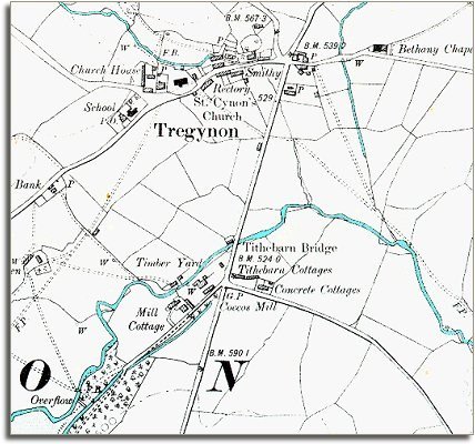
The image below is taken from an old Ordnance Survey map published at a scale of 6 inches = 1 mile in 1902. This allows us to see the community in more detail.
| Tregynon in 1902 | ||
|
The image below is taken from an old Ordnance Survey map published at a scale of 6 inches = 1 mile in 1902. This allows us to see the community in more detail. |
||
|
||
| Tregynon itself was still a small country village at the end of Queen Victoria's reign. It has a water mill and a smithy like most rural villages. there have been changes however which we can see from the map. | ||
| The village now has a school. This was very important for the children of the ordinary villagers who worked on the local estate. The new school offered these children more opportunities when they grew up. Instead of having no possibility of a life anywhere but working on the land, children were given enough education to enable some of them to do something different with their lives if they wanted it. | ||
| Compare with Tregynon in 1836 |