The map below is another enlarged
section of an Ordnance Survey map
made at a scale of 1 inch = 1 mile in 1836. Although it is not very detailed
it does give us an idea of the area in the early Victorian period.
The way the map is shaded gives us a very good idea of the
shape of the landscape. From this you can see that Tregynon
developed on a slope by the road linking Newtown and Llanfair Caereinion.
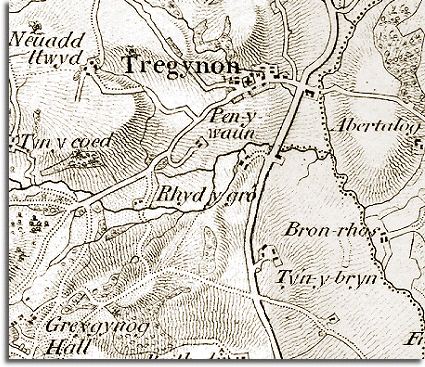
 In
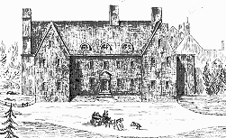
the bottom left hand corner of the map you can see Gregynog
Hall which was the centre of an important estate. (You can
see the hall as it must have looked at the time in this picture). Many
of the local farmers would have been tenants of the estate. Many of the
local children would have gone into service there when they were old enough,
working as servants at the house and its grounds.
In
the bottom left hand corner of the map you can see Gregynog
Hall which was the centre of an important estate. (You can
see the hall as it must have looked at the time in this picture). Many
of the local farmers would have been tenants of the estate. Many of the
local children would have gone into service there when they were old enough,
working as servants at the house and its grounds.