Llanfair and district
Victorian maps
  Manafon in 1836  
 

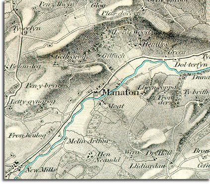
The map below is an enlarged section of an Ordnance Survey map made at a scale of 1 inch = 1 mile in 1836. Although it is not very detailed it does give us an idea of the area in the early Victorian period.
The way the map is shaded gives us a very good idea of the shape of the landscape. From this you can see that Manafon grew up at a ford on the river which was defended in medieval times by a moated stronhold.

 
  Map of Manafon in 1836
  At the beginning of Queen Victoria's reign there is still no bridge at Manafon and this must have created problems for travel in winter when the river was high. The nearest bridge on the map is to the South West at New Mills.  
  At this time you can see that people lived in a scatter of small farms and cottages. Manafon itself is just a church and a few houses.  
  Compare with Manafon in 1902  
 

Back to the Llanfair maps menu

Back to top
Go to Llanfair Caereinion menu