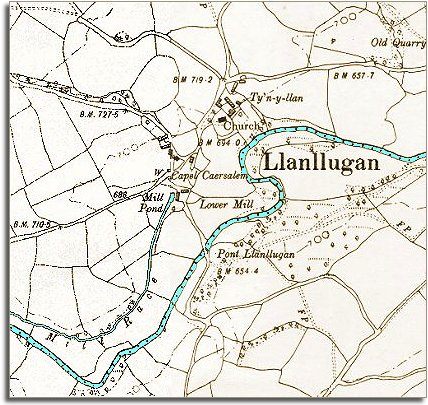
The map below is an enlarged detail put together from two Ordnance Survey maps made at a scale of 6 inches = 1 mile in 1902. It allows us to look in a bit more detail at the community at the end of Queen Victoria's reign.
| Llanllugan in 1902 | ||
|
The map below is an enlarged detail put together from two Ordnance Survey maps made at a scale of 6 inches = 1 mile in 1902. It allows us to look in a bit more detail at the community at the end of Queen Victoria's reign. |
||
|
||
| We can see the mill near the church marked under its English name of Lower Mill in more detail on this map. We can see the mill race bringing water across the fields to fill the mill pond which powers the mill wheel. Even at the end of the Victorian period when cars have been invented the mill is still providing a useful service in the community. | ||
| Compare with Llanllugan in 1836 |