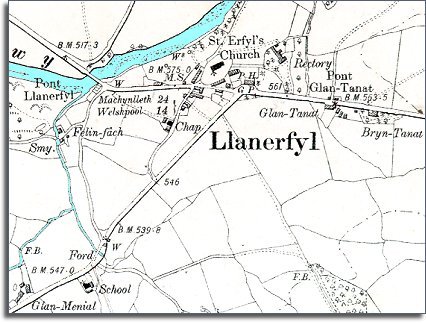
The map below is an enlarged detail put together from an Ordnance Survey map made at a scale of 6 inches = 1 mile in 1902. It allows us to look in a bit more detail at the community at the end of Queen Victoria's reign.
| Llanerfyl in 1902 | ||
|
The map below is an enlarged detail put together from an Ordnance Survey map made at a scale of 6 inches = 1 mile in 1902. It allows us to look in a bit more detail at the community at the end of Queen Victoria's reign. |
||
|
||
| At the end of Queen Victoria's reign the village is still a small rural community with a church, pub, corn mill and a smithy. There have not been any startling changes which are obvious on the map. | ||
| Like just about every other village in Wales, Llanerfyl now has a school. This was very important for the children of the ordinary villagers who worked on the land. The new school offered these children more opportunities when they grew up. Instead of having no possibility of a life anywhere but working on the land, children were given enough education to enable some of them to do something different with their lives. | ||
| Compare with Llanerfyl in 1836 |