Llanfair and district
Victorian maps
  Llanerfyl in 1836  
 

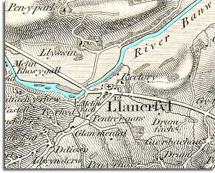
The map below is another enlarged section of an Ordnance Survey map made at a scale of 1 inch = 1 mile in 1836. Although it is not very detailed it does give us an idea of the area in the early Victorian period.
The way the map is shaded gives us a very good idea of the shape of the landscape. From this you can see that Llanerfyl developed - like Llanfair - at a crossing point on the River Banw.

 
  map of Llanerfyl in 1836
  You can see from the map that the settlement of Llanerfyl itself is very small at this time and consists of the church and a small cluster of houses.  
  In such an upland the people would be settled in a scatter of small farms and cottages. Almost all the local people would be involved in working on the land in some way or providing services to farmers like the local miller (notice the mill marked Melin fach) or blacksmith.  
  Compare with Llanerfyl in 1902  
 

Back to the Llanfair maps menu

Back to top
Go to Llanfair Caereinion menu