Llanfair and district
Victorian maps
  Castle Caereinion in 1902  
 

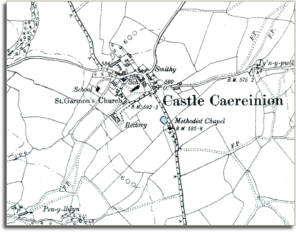
The map below is a section of a map made at a scale of 6 inches = 1 mile in 1902. It is more detailed than the 1836 map of the town and we can see more of the hamlet itself and some of the changes which have come during the long reign of Queen Victoria.


  This small rural hamlet has grown slightly but is still small. Perhaps the most important change is the village school. By the end of Victoria's reign all children in the parish had an education, even those from the poorest families. This meant they had more opportunities when they grew up. Instead of having no posssibility of a life anywhere but working on the land, children were given enough education to enable some of them to do something different with their lives.  
  Compare with Castle Caereinion in 1836  
 

Back to the Llanfair maps menu

Back to top
Go to Llanfair Caereinion menu