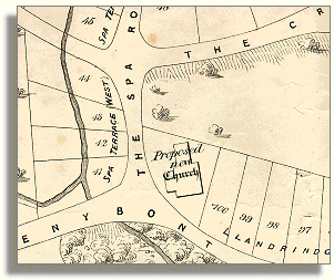
Llandrindod and district
Taking the waters
  Making money from water  
 

The people who benefited most from the enclosure, or allocation to private ownership, of what was previously common land open to everyone were the already wealthy landowners of the district.
Companies were formed to parcel up the land into separate lots for the building of houses and hotels.

 
An 1869 map
showing
plots of land
for sale
Part of 1869 map
The portion 
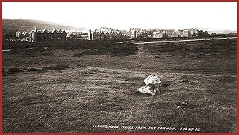
of map on the left shows part of the former common land in Llandrindod marked out as building plots for sale in 1869. The 'Proposed new Church" was never built, and the Automobile Palace of 1911 now occupies the site.
The road at top right, marked out as 'The Crescent' is now Princes Avenue, which leads to Llandrindod Lake.
There are a number of early photographs of Llandrindod Wells taken when the town was being developed to provide accommodation and other facilities for visitors.
Many show the new buildings clustered together but still surrounded by rather bleak open country, as in this picture postcard view which probably dates from the late 1880s.
Llandrindod from the common.
 

New streets were created and were lined with the large and very solidly built apartments, boarding houses, hotels and shops typical of the Victorian age. You can see another view of part of the town as seen from the common on one of our picture pages.
Very large sums of money were invested in building the new town where only rough common land existed before, but the risk paid off and visitors came for many years.

Back to 'taking the waters' menu


Link to sources
Back to top
Go to Llandrindod menu
RDR