| |
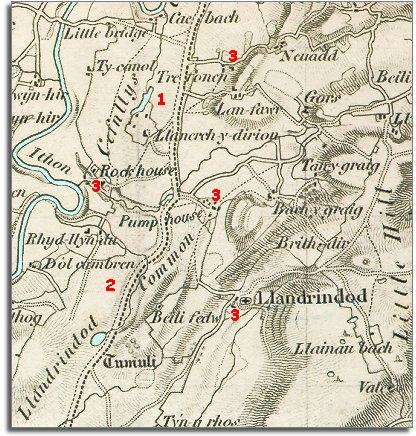
1.
Where the Northern end of the town now stands is the wet and
windswept area known as Cefnllys Common.
The only building marked on the map on this common is Llanerch-y-dirion
which we know today as the Llanerch Inn. |
|
| |
2.
Where the Southern end of the town now stands is Llandrindod
Common. Again this is a wet open area of grazing land.
|
|
| |
3.
Although the town did not exist in
1833, people had been visiting the area to take the waters for some time.
The buildings marked 3 (Rock House,
Trefonen, The Pump House Hotel and Llandrindod hall) all offered accommodation
for visitors. |
|
| |
Compare
with a map of the area in 1887.. |
|
| |
Back to Llandrindod
maps menu..
|
|
|
|
|
|