| Kerry in 1903 | ||
|
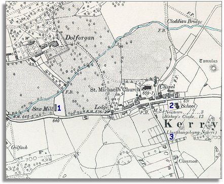
The map below is a section of a map
made at a scale of 6 inches to
1 mile in 1903. |
|
|
The map shows us more detail in the landscape, and the most important thing to notice is that not much has changed on the map. Kerry is still a small rural village on the edge of an estate. There have been one or two small changes however. 1. Dolforgan has expanded into forestry and has built a sawmill for cutting up the felled trees into saleable timber. This movement of trees and timber would all have been pulled by horses. 2. As at Betws Cedewain and hundreds of other small communities across Powys a new village school has been built. By the time this map was made all local children got an education. This gave all the children a better awareness of the world outside and new skills like reading and writing. For a few children this opened up new opportunities when they were older. 3. Down the lane south of the village new cottages have been built, and part of a field has been divided up for allotments. On these small plots of land poorer families grew their own vegetables. This could make an important contribution to the diet (and health) of the family. |
|
|
||