Newtown and district
Victorian maps
  Betws Cedewain in 1839  

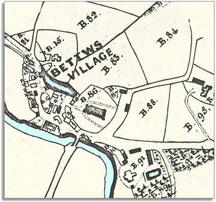
The map below is based on a detail from the tithe map for Betws Cedewain parish and it gives us a picture of the village in the early years of Queen Victoria's reign. Look below to find out more.

The original map was not aligned with North at the top so we have turned it round to make it easier to compare with later maps.

TITHE MAPS
In Victorian times almost everyone had to pay tithes to the Church of England. At the beginning of the reign the tithe became a tax on your property. The maps were drawn to see what property everybody had
.
  At the centre of the village (marked B.86) is the parish church in its graveyard. Just to the left you can see the pond of the local mill. From the map we can see that the village has grown up at a place where two roads meet and there is a crossing point over the river.  
  This little community has always been a rural community with local people working on the land. The 1841 census tells us about the other people earning a living in the area.  
 
In this little village and the surrounding area were:-
6 shoemakers, 3 sawyers, 3 blacksmiths (Evan Jones and 2 young assistants), 3 weavers, a shopkeeper, a joiner, a timber merchant and a schoolmaster. The village had 2 inns - the New Inn and the Talbot Inn. The vicar was Henry Butler who lived in the village with his family and servants. At Betws Hall lived the 70 year old Richard Blayney.
 
  Compare with Betws Cedewain in 1903..  
 

Back to the Newtown maps menu

Back to top
Go to Newtown menu