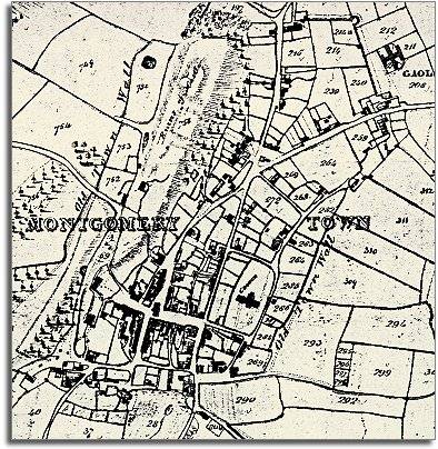
The map below is based on a detail
from the tithe map for Montgomery
parish, and it gives us a picture of the town in the early years of Queen
Victoria's reign.
Montgomery in 1839 appears little
changed from the town a hundred years earlier. The wider open market space
of Broad Street is at the heart of
the town. Here are most of the shops and houses. The further away from
here you go the more open are the spaces.

TITHE MAPS
In Victorian times almost everyone had to pay tithes to the Church of England. At the beginning of the reign the tithe became a tax on your property. The maps were drawn to see what property everybody had