
TITHE MAPS
In Victorian times almost everyone had to pay tithes to the Church of England. At the beginning of the reign the tithe became a tax on your property. The maps were drawn to see what property everybody had.
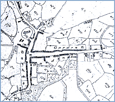
The familiar shape of a letter 'T' on its side is still there in the year 2000. In 1842 though there was nothing but gardens behind the houses along these streets.
The town then consisted of Maengwyn Street, Pentrerhedyn Street and Penrallt Street and little else.
Notice also the old Market Hall standing at the junction of the Streets where the later clock tower stands.