
TITHE MAPS
In Victorian times almost everyone had to pay tithes to the Church of England. At the beginning of the reign the tithe became a tax on your property. The maps were drawn to see what property everybody had
 Powys
County Archives
Powys
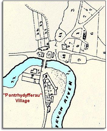
County Archives| "Pontrhydyfferau" hamlet around 1845 | ||
|
The surveyors who made the tithe map of Llanwrtyd parish included this small detail of the hamlet itself. Even though people did travel here to take the waters at this time, the 1841 census recorded just 27 people at the hamlet. |
|
TITHE MAPS In Victorian times almost everyone had to pay tithes to the Church of England. At the beginning of the reign the tithe became a tax on your property. The maps were drawn to see what property everybody had |
Powys
County Archives |
|
|
The inhabitants in 1841 included
David Protheroe who ran the New Inn,
and Rees Price who ran the smithy
with his son Thomas. |
||
| Compare with a map of the area in 1887.. | ||
|
|
||