| Llangamarch Wells in 1888 | ||
|
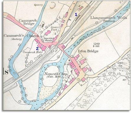
The image below is based on an Ordnance Survey map published in 1888 at a scale of 1 mile = 25 inches. Although the hamlet is still quite small you can see at a glance that there have been changes during Victoria's reign. |
|
|
|
|
|
1. The railway has come to Llangamarch. (Straight through the middle of Llangamarch in fact!) Just as it did at Llanwrtyd, Builth and Llandrindod, this allowed local people to develop the local mineral springs into a thriving spa attracting visitors and providing employment. |
||
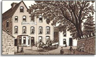 2.
Although the local mineral springs are off the edge of this map we can see
one of the successful hotels that grew up to cater for visitors coming to
take the waters. Like the other local hotels, the Cammarch
Hotel provided many kinds of entertainment for its guests. It
had a concert room, tennis courts, reading and smoking rooms and was handy
for fishing and visiting the mineral springs. 2.
Although the local mineral springs are off the edge of this map we can see
one of the successful hotels that grew up to cater for visitors coming to
take the waters. Like the other local hotels, the Cammarch
Hotel provided many kinds of entertainment for its guests. It
had a concert room, tennis courts, reading and smoking rooms and was handy
for fishing and visiting the mineral springs. |
||
| Compare with a map of Llangamarch around 1840.. | ||
|
|
||