| Beulah in 1888 | ||
|
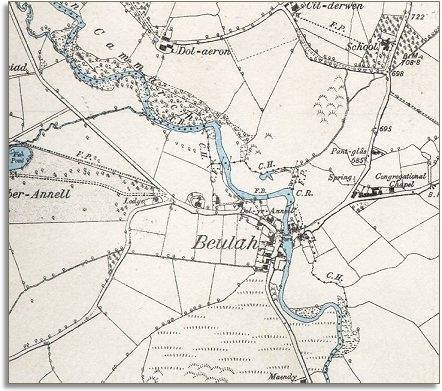
The map below is a section of a map made at a scale of 6 inches = 1 mile in 1888. From this we can see that the hamlet of Beulah by the ford on the Camarch has developed in the 50 or so years since the 1833 map. |
|
|
|
|
|
There is still no bridge over the river but a number of houses have been built and a community has sprung up along the roadside named after the local chapel. |
||
| Compare with a map of the area in 1833.. | ||
|
|
||