| Beulah hamletin 1833 (or not!) | ||
|
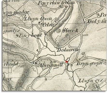
Below is a small part of a larger map made by the surveyors of the Ordnance Survey in 1833. It was made at a scale of 1 inch = 1 mile and we have enlarged it here. The map gives us an idea of this part of the Cammarch valley at the beginning of Queen Victoria's reign. |
|
||
|
The first thing you will notice is that Beulah does not exist! The river crossing marked with a red star shows the site of the hamlet but we can see that in 1833 there was no hamlet there at all. |
||
| Compare with a map of the area in 1888.. | ||
|
|
||